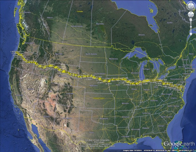
A number of friends have asked to see the details of the route I’ve planned for the walk. Below is a screen shot of the Google Earth rendition of the route, including waypoints for each day, as currently scheduled (assuming a 3 FEB start):
I also have the very detailed “turn-by-turn” tracks for each of the ~50 legs of the walk, but I’ll save that for those who plan on joining me.
Enjoy!
